There’s nothing like a hike in the woods. Join researcher Sandra Yaacoub as she learns about lynxes, trees, and some very invasive insects!
Greetings from the Yukon, Earth Rangers! I’m here doing some pretty intense work in the habitat of one of my favorite cats: the lynx!
A Lynx’s Home
Have you ever seen a lynx before? It might surprise you to learn that they aren’t very big – they only weigh about nine kilograms (20 pounds). That’s not much larger than your average housecat! But lynxes are built for life outdoors. They have wide, snowshoe-like paws that help them travel easily in the snow, and a thick, fluffy coat to keep them warm.
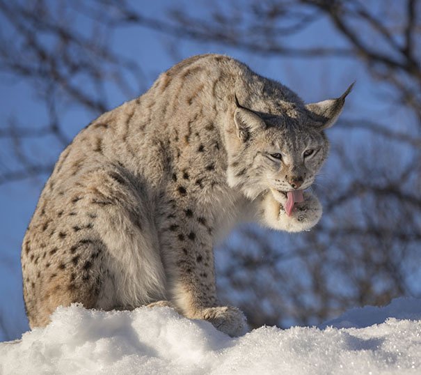
Lynxes live in boreal forests all across the Yukon. They prefer areas with a lot of trees because they often shelter under fallen logs and bushes. And that’s where I come into things: I’m studying the health of the forests lynxes call home.
Infestation Situation
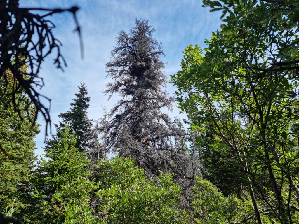
Back in the 1990’s, an insect called a spruce bark beetle attacked many forests across North America. The forests in the Yukon were badly affected. Spruce bark beetles are destructive, because they bore into the deeper layers of tree trunks and lay their eggs. Gradually, the insects take over the inside of the tree and it dies.
A Tree-mendous Recovery
The good news is that forests can and do recover. My team and I visited 115 locations across the Yukon and took inventory of the conditions there. We found out over 30% of standing trees were killed by the spruce bark beetle. But, happily, many others survived or re-grew.
Recovery isn’t the same across all sites, but overall we know it can take up to 50 years for a forest to make a comeback after an infestation. How do we know that? We measure the trees! We don’t do it all by hand (that would take WAY too long). Instead, we use technology to help us see how the trees are growing. By using the data we collect on the ground, we can ‘teach’ computer models. They use data captured by sensors (attached to airplanes and satellites) to tell us about the conditions of the forests, like its structure and health. Using this information, I’ve been able to make maps of tree height, shrub cover, and live and dead trees – among other things!
What’s Next?
Right now, I’m at the Kluane Lake Research Station in Kluane, Yukon. I’m sharing all of my maps of forest conditions with local governments and other important folks. We’ve had really exciting conversations about how the maps can be used.
I’ve also been working really closely with First Nation communities to provide them with updated forest inventory maps. The maps will give them useful information about finding wood locally in a sustainable manner. In the past, researchers haven’t done the best job engaging with local communities. This is changing, thanks to help from YOU, Earth Rangers. As a PhD student, I’m able to build positive relationships and benefit science – that’s a HUGE win!
Thanks for following my journey, Earth Rangers!
Wsupman
That’s cool
Just curious
Just curious
toofunny
Thanks
That was SOOOOOOOOOOOOOOOOOOO long to read just too long
That was interesting soo interesting
So cool
Interesting.